Just What We Don’t Need – More Rain and Wind Coming!
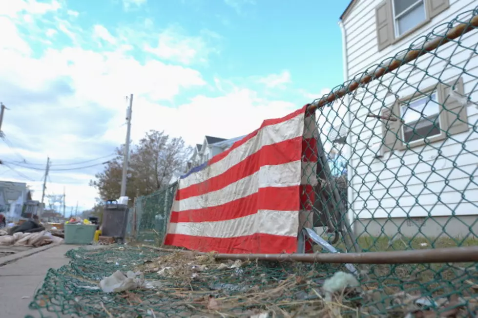
As we try to continue to recover from last week's devastating "Super Storm", potentially more weather problems could smack the Jersey Shore line with inches of rain and high winds.
As unthinkable as it could seem, another Nor'easter is developing! Although this storm system is going to be nowhere near what was last week's Storm Of The Century, this will add rain and wind to our South Jersey area - something we do not need as we try to recover.
Reports have this storm coming in for Wednesday night, with the heaviest part of the system hitting Long Island (another place that does not need this!) Predictions are seen to be in the neighborhood of 1-3 inches of rain to our area, plus gust that could range from 45-65 MPH.
Any extra rain will bring back flooding to South Jersey (Coastal Flood Watch is up for Cumberland, Cape May, Atlantic, Ocean and Monmouth Counties), and obviously stall efforts to continue the dig out. The wind could toss around more sand to areas that already been buried, so monitoring this system becomes important to all South Jersey residents.
The closer you live to Philly, the more of a chance you will see the first snow of the season in the form of wet snow that should not bring any accumulations. Action News on 6 ABC in Philly is predicting that snow accumulations of 1-3 inches are possible north and west of Philly.
This storm will linger into Thursday, then comes sunshine and 60s for the weekend. Keep in tune to SoJO and sojo1049.com for more updates.
More From SoJO 104.9 FM


![Sinkhole Opens Up in South Jersey Town After Heavy Rains [VIDEO]](http://townsquare.media/site/398/files/2015/06/sinkhole.jpg?w=980&q=75)
![Adorable Kids Argue If It’s Raining or Sprinkling Outside [VIDEO]](http://townsquare.media/site/398/files/2014/09/hqdefault24.jpg?w=980&q=75)