This Insulting Map of New Jersey Stereotypes Has People Livid
We've all seen the north, central, south Jersey maps, even the pork roll vs. Taylor ham maps floating around, but this latest collection takes dividing the Garden State to new extremes.
These six maps of New Jersey originated on Reddit, but have become viral. One harmless map divides the state based on how you tell someone where you live by like the Turnpike or Parkway for example.

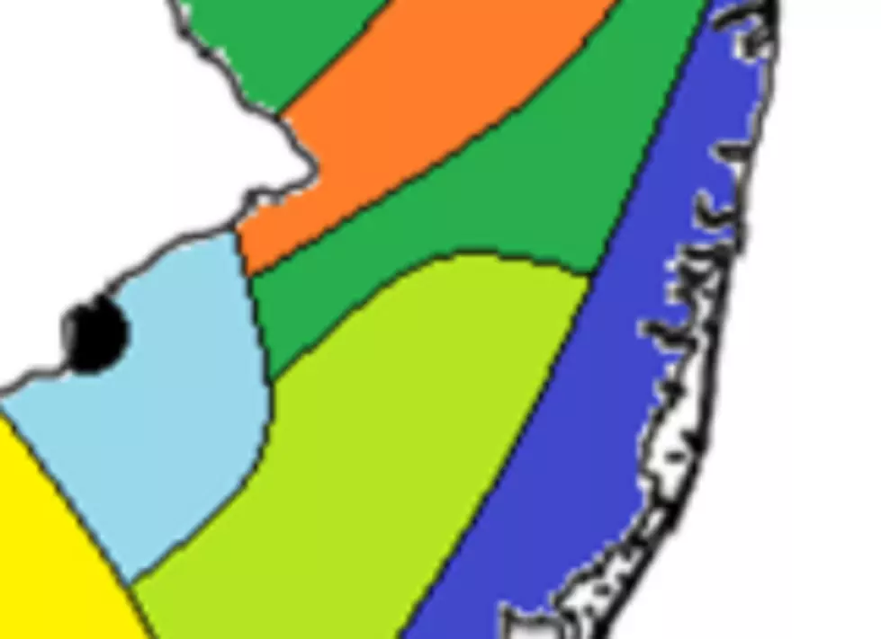
The map that has people talking is this one.
All things considered, all of us in Monmouth and Ocean counties faired pretty well with the two counties being considered "The Shore," "Farmlands," and "Pineys." Not too bad, right?
However, look at some of the other areas of the state like the "Armpit of NJ." That would be Camden, by the way.
Nearly a quarter of north Jersey is labeled "Hill People," Cumberland, Gloucester, and Salem counties are considered to be "Basically Alabama," and Atlantic City is dubbed "Knock-off Vegas."
Much of Burlington and some of Camden county show up as "Thinks they are Philly," while up north a good chunk of Bergen, Essex, and Hudson counties "Think they are New York."
The label I found the most interesting is for parts of Mercer, Middlesex, and Somerset. That label is "Diversity." That's a very vague stereotype. Is it good, or bad? I'll leave that up to you.
Are these maps accurate? Shoot me an email at Matt.Ryan@townsquaremedia.com.
The Jersey Shore Businesses We've Lost During COVID
LOOK INSIDE: The Most Expensive House in Rumson
WHERE DID THEY GO? Here are 50 of your favorite retail chains that no longer exist.

More From SoJO 104.9 FM