
NJ Air Quality Alert: When will smoke and haze worsen? And improve?
UPDATE... This article is outdated...
For the latest smoke, haze, and air quality alert information, please refer to my newest weather blog post.
UPDATE as of 3 p.m. Wednesday...
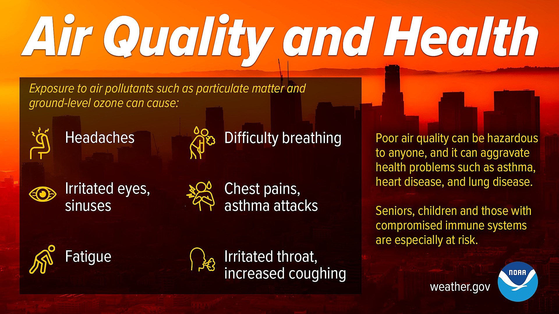
As you probably noticed, smoke has once again surged south into New Jersey. The air has turned a disgusting shade of orange, brown, or grey. And it is thick with smoke particulates, making it downright hazardous to breathe in spots.
The Air Quality Index across New Jersey has surged into the "Unhealthy" and "Very Unhealthy" range. As a result, NJ's Air Quality Alert has been upgraded to "Code Red" and now extends through Thursday night.
Visibility and air quality are not expected to improve until sometime Thursday. Stay indoors with windows closed as much as possible.
ORIGINAL POST from 7:25 a.m. Wednesday...
Air Quality Alert
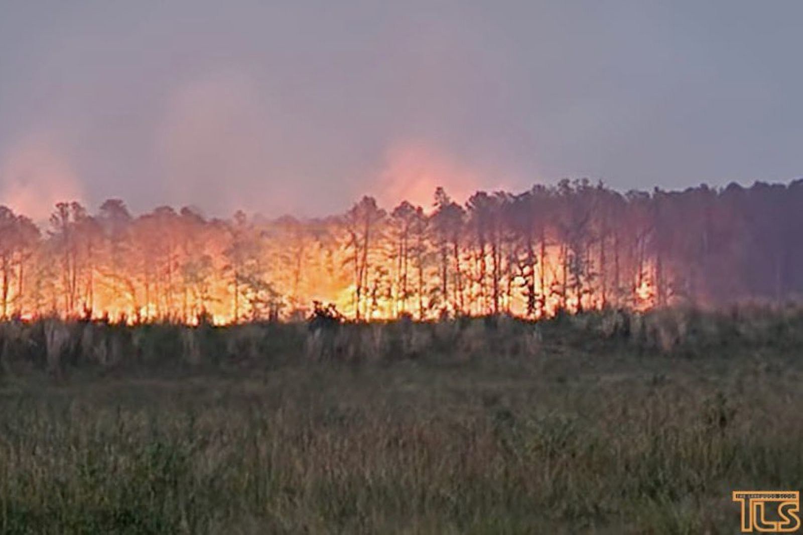
If you went outside any time in the last 24 hours, you know our main weather headline involves smoke. Believe it or not, this plume of smoke stems from wildfires over Quebec, Canada — upwards of 500 miles away. (Yes there is an out-of-control fire in Jackson Township, New Jersey, too. But those smoke effects are pretty localized.)
So we have a hazy, ominous sky. And a strong smoky smell in the air. And poor air quality.
And I do mean poor. The Air Quality Index (AQI) over parts of New Jersey has registered as high as 178 Wednesday morning, due to fine particulates in the air. That is firmly in the red "Unhealthy" range — I can't say I've ever seen it that high.
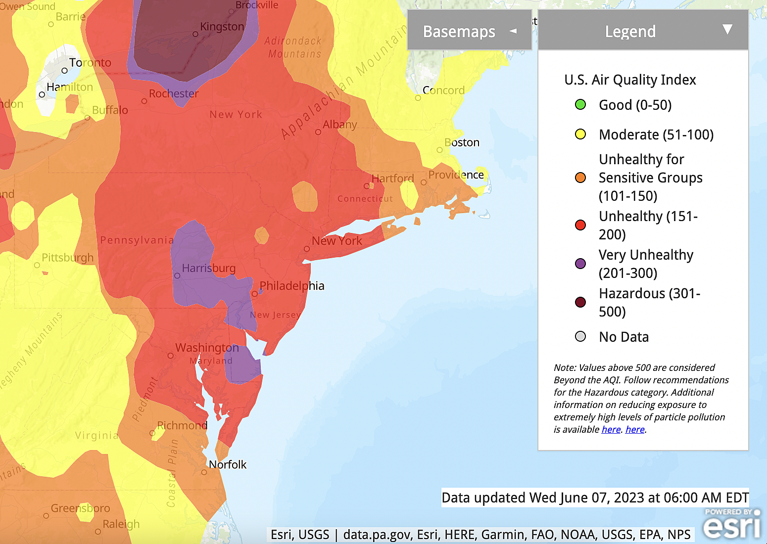
The NJ Department of Environmental Protection and the National Weather Service continues an Air Quality Alert for the state Wednesday. It is "Code Orange," which suggests the air will be "Unhealthy for Sensitive Groups". The very young, the very old, those with compromised immune systems, and those with heart and lung conditions should stay indoor as much as possible Wednesday. Keep windows closed.
The smoke and the air quality is so bad... It makes you wonder how much worse it would be on a "Code Red" or "Code Purple" day.
Smoke Forecast
Let's talk about the question on everyone's mind: When the smoke conditions will improve.
Bottom line: We need a wind shift, to blow the Canadian wildfire smoke plume away from New Jersey. That will take some time, but it is coming.
The Rapid Refresh plume model shows the concentration of smoke particles in New Jersey's atmosphere will actually thin out for a few hours, starting around mid-morning Wednesday. That is good news. You will still see hazy skies and an obscured sun. And you'll probably still smell smoke. But air quality should improve slightly through the morning hours.

However, that will not last all day. Starting in the afternoon and peaking Wednesday evening, an even thicker pocket of smoke will fly overhead. Visibility will drop, the odor will intensify, and air quality will turn unhealthier once again.
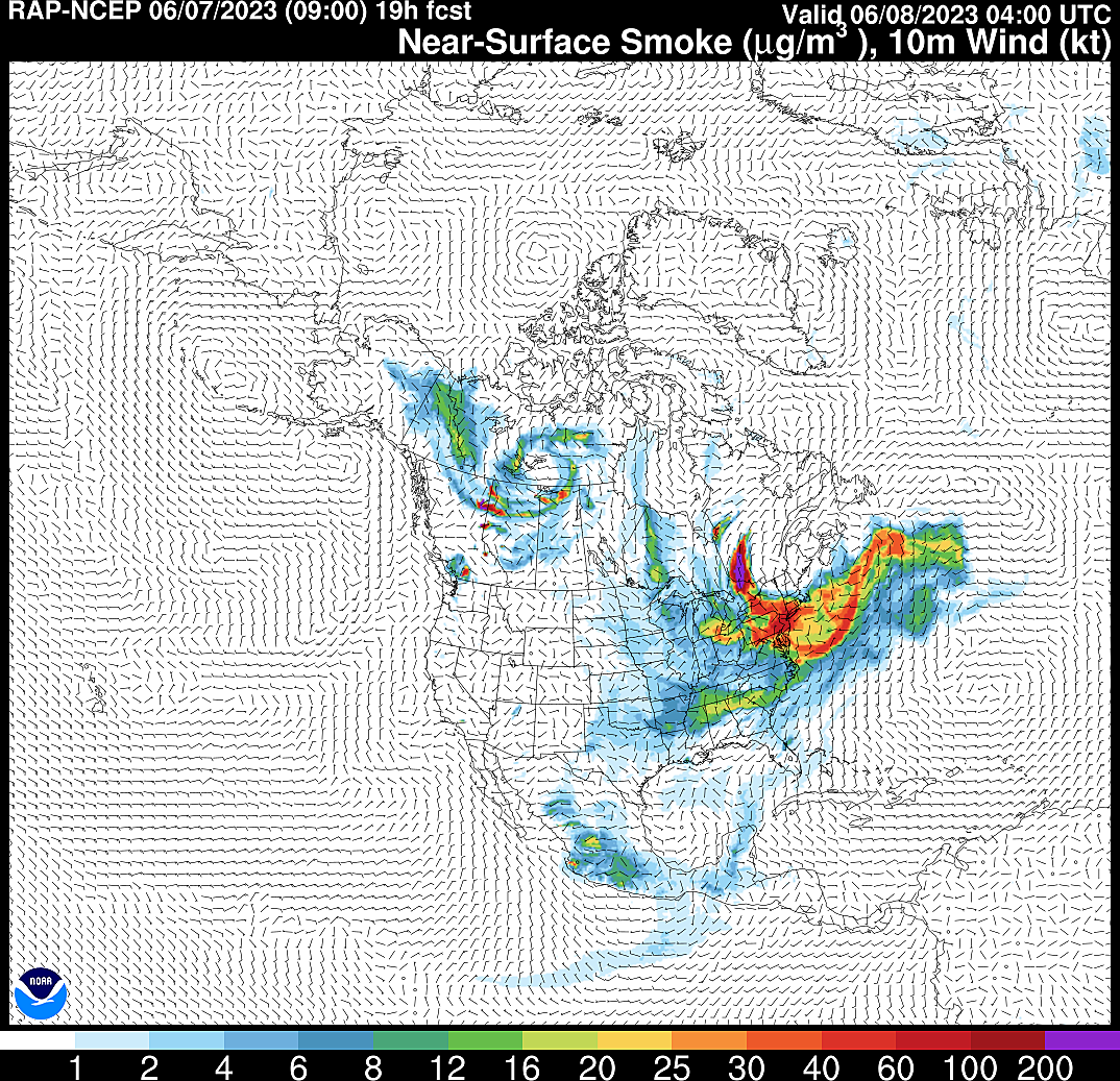
By Thursday afternoon, a subtle wind shift should carry the thickest plume farther west — more over western Pennsylvania than New Jersey.
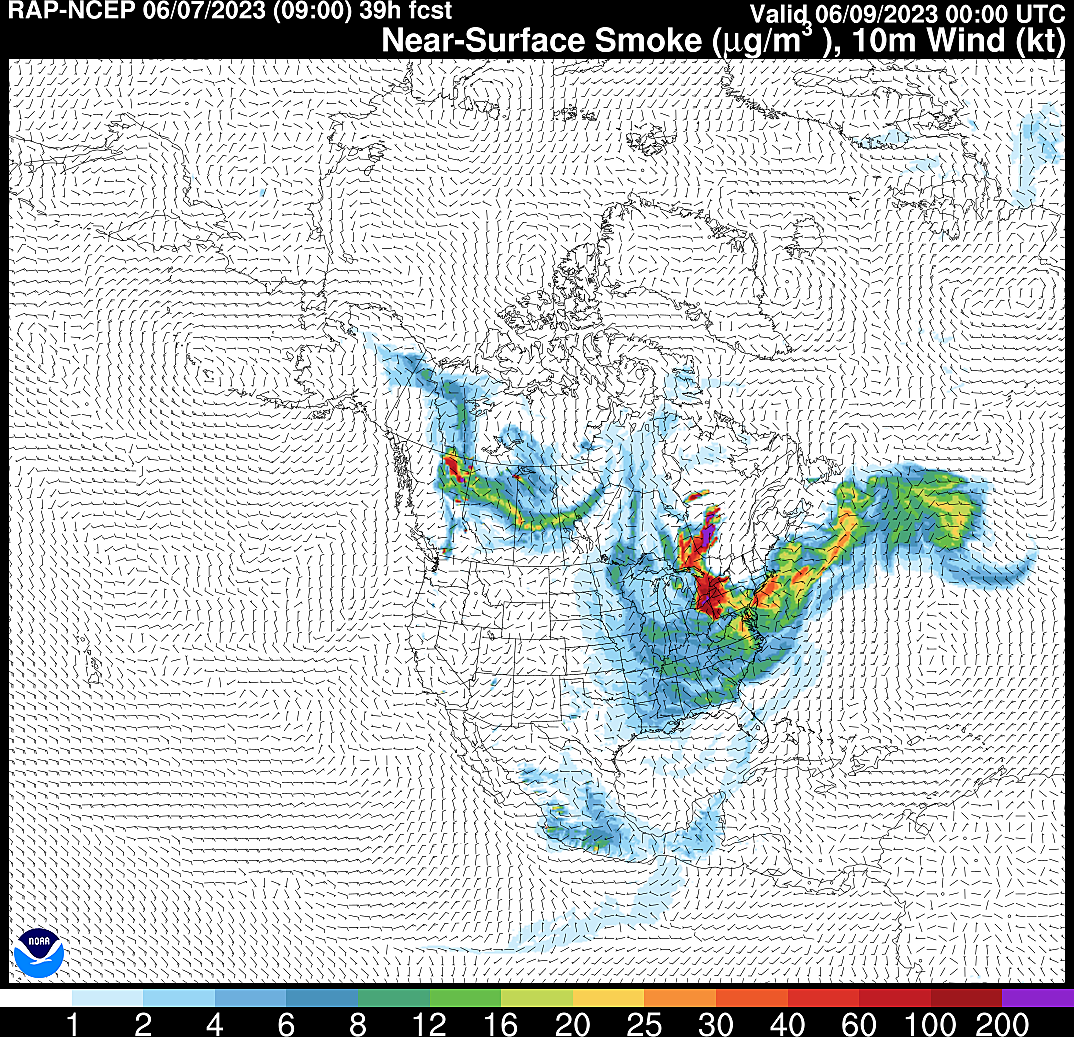
Our concentration of smoke particulates should end up much lower on Thursday. There could be some haze, but I doubt the smoky smell will linger.
There is also a chance the smoke drifts back again late Thursday into Friday and possible Saturday. And then our prevailing winds turn southerly from Sunday into early next week, putting an end to our smoke concerns.

Fire Danger
Technically, New Jersey's wildfire danger will go down for Wednesday because of lighter winds. Therefore, there will be no "Red Flag Warning" this time around. However, the brush is still dry. And relative humidity is turning even lower. So it's still a precarious situation around the Pine Barrens and beyond.
The Rest of the Weather Forecast
The smoke condition is unfortunate — because otherwise, Wednesday would have been a dropdead gorgeous early June day.
We'll see hazy sunshine and dry weather Wednesday. High temperatures will be about 5 degrees cooler than Tuesday, in the mid 70s.
Wednesday night stays quiet and mainly clear, with lows in the 50s.
The cooling trend continues into Thursday, as highs settle in the lower 70s. Still pretty pleasant, with partly sunny skies. A few isolated showers are possible from midday through the afternoon.
Friday will be about the same, with a mix of clouds and sun and highs limited to around 70 degrees. Once again, there will be a chance for a few showers and thunderstorms during the day.
Heading into the weekend, Saturday will be very nice — if it's not too hazy. Partly sunny skies will push highs back into the mid 70s.
Sunday gets notably warmer and more humid. Highs in the 80s (away from the coast), as dew points surge into the 60s. We'll see mostly cloudy skies and southerly winds for the second half of the weekend.
New Jersey's next opportunity for impactful, widespread rain won't be until early next week. Right now, models show Monday to be an unsettled and pretty wet day. Total rainfall of a half-inch to an inch? We'll take every drop we can get.
NJ's crazy haze, choking smoke, and sinister sky
Gallery Credit: Dan Zarrow
Dan Zarrow is Chief Meteorologist for Townsquare Media New Jersey. Follow him on Facebook or Twitter for the latest forecast and realtime weather updates.
Photos of Some of South Jersey Firefighters Most Memorable Fires
Gallery Credit: Eddie Davis
More From SoJO 104.9 FM
