Isasis damage: 1 million without power, some may be out for days
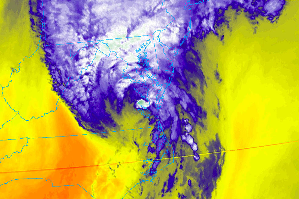
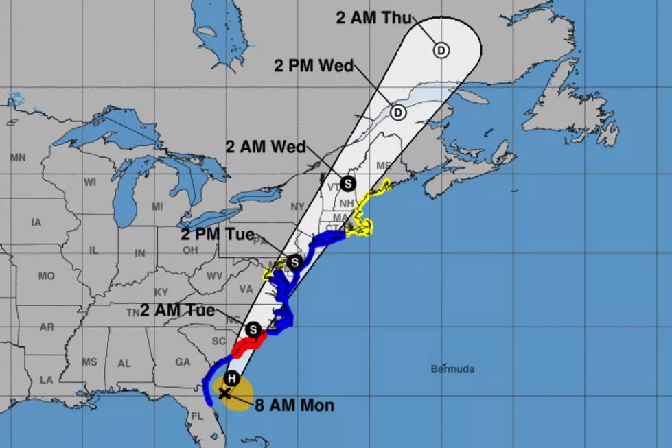
Fast-moving tropical storm Isasis hit New Jersey for only a few hours Tuesday, but the cleanup of fallen trees resulting from its high winds and heavy rains will take days to complete.
The storm had wind gusts of over 70 mph along the shore, dropped more than four inches of rain inland and left 1.4 million people without power — with roughly 1 million still out as of Wednesday morning.
A tornado was confirmed by the National Weather Service in the Strathmere section of Upper Township It also confirmed a water spout, which can be called a "tornado over water" off Ship Bottom on Long Beach Island in Ocean County with a wind gust of 109 mph.
New Jersey 101.5 chief meteorologist Dan Zarrow said Wednesday's weather will be ideal for crews working to restore power with temperatures in the 80s and sunny skies.
"Aside from potential thunderstorms, there are no wind concerns for the next week. 15 mph, tops. The next heat wave starts on Monday with temperatures in the 90s," Zarrow said.
As of 8:25 a.m. Wednesday, the state's largest electric utilities were reporting the following outages:.
• JCP&L: 563,288 (Monmouth, Morris, Ocean hardest hit)
• PSE&G: 301,546 (Bergen, Burlington, Essex)
• Atlantic City Electric: 74,179 (Ocean, Atlantic, Cape May)
• Orange & Rockland: 42,345 (Bergen)
JCP&L said it had “an army of 3,000 workers” working around the clock to restore power and another 1,200 resources joining in. The utility has staging areas in Jackson Township, Oceanport and Livingston.
PSE&G said it has 2,800 workers, including mutual aid from as far as Nova Scotia.
Atlantic City Electric posted estimate restoration times for its customers of Saturday night; the other utilities did not.
JCP&L and PSE&G said it was still too early to give an estimate of when most power would be restored. Atlantic City Electric on its website estimated restoration would be complete by Saturday at 11 p.m. State officials suggested Tuesday, even before the storm hit, that restoration could take days for many residents.
Gov. Murphy will visit Jackson on Wednesday morning to assess storm damage in Ocean County.
NJ Transit suspended most rail service on Wednesday morning but will resume service on a weekend schedule at 10 a.m. on the Northeast Corridor, Raritan Valley, Main/Bergen County and Pascack Valley Lines.
The Atlantic City Line, along with bus, light rail and Access Link services operated on a regular weekday schedule on Wednesday.
Scores of roads remained closed on Wednesday, including Route 202 in Bernardsville, Route 514 in Millstone, Route 27 in Edison, Route 35 in Middletown, Route 36 in Hazlet and West Long Branch, Route 71 in Spring Lake and Route 33 in Hamilton and Hightstown.
State offices and agencies will reopen on Wednesday their regular hours. The state division of Parks and Forestry expected some state parks and forests to delay their opening with exact locations and times to be announced on the state park social media.
The Cape May County Park and Zoo will close on Wednesday to allow cleanup from the storm including damage to a fence and pavilion.
"We lost at least 30 trees and treetops and have quite a bit of work to do to make it safe for you to visit again," the zoo wrote on its Facebook page, adding that the all the animals are safe.
Red Cross New Jersey reported assisting families whose homes were damaged by trees in Freehold, Hillside, Trenton, Union City and Wharton.
Contact reporter Dan Alexander at Dan.Alexander@townsquaremedia.com or via Twitter @DanAlexanderNJ
More from New Jersey 101.5:
Damage from Isaias in New Jersey
More From SoJO 104.9 FM


![Ocean City Church Steeple Topples During Tropical Storm Isaias [VIDEO]](http://townsquare.media/site/398/files/2020/08/Chapel.jpg?w=980&q=75)
![Tornado Spotted in Marmora Near Tuckahoe Road [VIDEO]](http://townsquare.media/site/398/files/2020/08/Marmora-Tornado.jpg?w=980&q=75)
