
Where is winter, NJ? More mild 50s, with a few rain showers
The Bottom Line
What happened to winter? I dunno. I feel so bad for snow plow drivers, snow resort operators, and anyone who bought a snowblower this year.
Yes, we've had two dramatic cold snaps. But for significant snow, we need a sustaining pool of available cold air. And at the same time, the predominant storm track needs to be just right. As we have discussed, a major culprit of this weird season is the continuing La Nina conditions (when the eastern equatorial Pacific Ocean is relatively cool and the western Pacific is relatively warm).
As I have hinted, there is still no end in sight to the generally above-normal temperatures and almost totally snow-free forecast. There are way more 50s in the forecast through next week than anything else.
While Wednesday was spectacularly springlike, Thursday will be blah, with clouds and spotty showers.. But at least temperatures will stay mild. Friday turns a bit windy. The weekend will be cooler, with a coastal storm system set to clip NJ on Sunday. Surprise, surprise — it looks like another rainmaker.

Thursday
We start the day with temperatures in the 20s (inland) to around 40 (coast). The southern coast (southern Ocean, Atlantic, and Cape May counties) are shrouded in fog. Visibility is down to a quarter-mile in spots. And because inland areas are just below the freezing mark there, you may have to watch for slippery spots. (We call that freezing fog.)
A sizable block of rain is just to the west of New Jersey. But most of that will dive north and miss us. While I do have a statewide shower chance in the forecast, those raindrops are going to be very much few and far between. The best chance of a shower will be in far northern New Jersey around late Thursday morning. Statewide, the best chance of a sprinkle would be just after sunset.
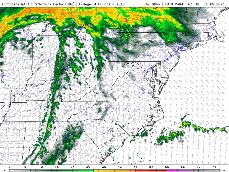
Meanwhile, skies will turn mostly cloudy to overcast early on Thursday. Winds will be light. And temperatures will still reach way above normal for early February. By the afternoon, we should see widespread 50s again. (Outside of NW NJ, which will be stuck closer to 40 degrees.)
And those temperatures will hold steady (or even rise further) into Thursday evening. Parts of the state could flirt with 60 by Midnight. I have to keep a shower chance alive through the overnight hours too.
Friday
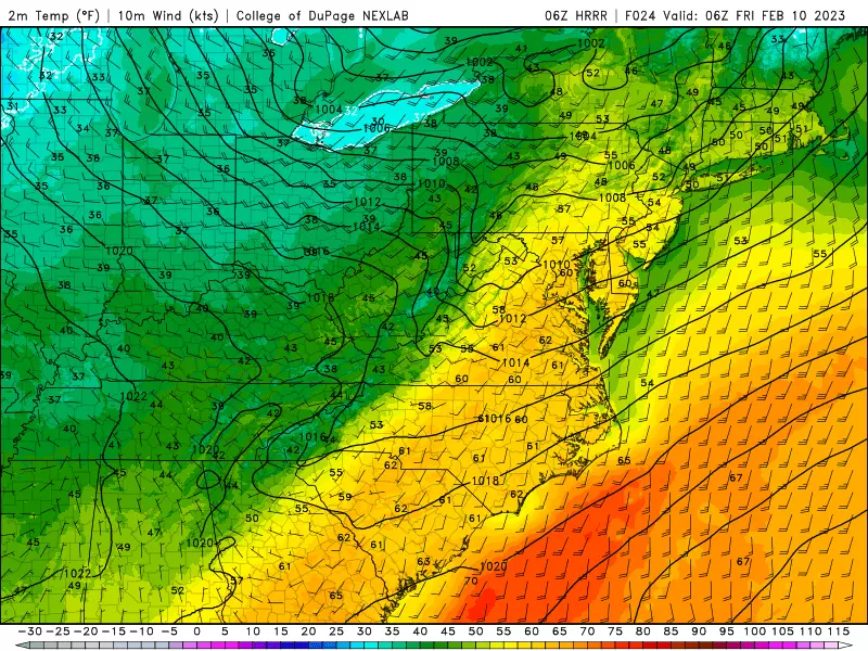
Early Friday morning, temperatures should slide back slightly into the upper 40s. I will remind you that is still warmer than the normal high temperature for this time of year.
Friday will still be mild, pushing into the mid 50s by midday. It will be partly sunny. And dry. All good news.
But Friday is a transition day, as a new air mass starts to arrive from the west. That means a brisk wind is going to kick up, occasionally gusting to 30 mph.
Temperatures may start to slide backward before sunset. But overall, Friday's temperature trend looks diurnal — meaning the warmest part of the day will be in (or close to) the afternoon.
Saturday
Back to February-ish weather. For a day or two, at least.
Highs on Saturday will come down to the lower to mid 40s. Normal highs right now are 42 to 45 degrees, so we are right in that zone.
I'm going for a mostly sunny sky on Saturday, as our atmosphere dries out nicely. It may be a little blustery, with a chilly northwest breeze. (Although not as gusty as Friday.)
Worth mentioning, a few models pop in a sprinkle or flurry Saturday evening.
Sunday
The big driver of Sunday's weather will be a coastal storm system. We have been watching this one all week. And on Wednesday, I posited three potential storm tracks: a complete miss, a glancing blow of rain, and a more direct hit of snow and rain.
Well, model guidance has come into agreement. And it's the middle one — a rainmaker — that looks to win out.
Far southern NJ — literally Cape May County — could see a rain or wintry mix shower early Saturday morning.
For the rest of the state, a band of rain will likely bubble up from the south starting around mid-afternoon. Things look pretty wet through Sunday night. SE NJ could see upwards of an inch of total rainfall through early Monday morning. Totals will be much lower to the north and west, away from the core of this coastal low.
Monday & Beyond
Showers may linger through mid-morning Monday, then skies will dry out and partially clear. Another warmup will kick-in next week, as we make a run for the upper 40s Monday afternoon.
50s return on Tuesday. Wednesday too, although models show a chance of rain.
Next big cooldown is set to arrive next next weekend. Will we see a batch of snow alongside that colder, more seasonable weather? Eh, don't hold your breath.
Dan Zarrow is Chief Meteorologist for Townsquare Media New Jersey. Follow him on Facebook or Twitter for the latest forecast and realtime weather updates.
Some of the cutest pets in New Jersey from last year!
Gallery Credit: New Jersey 101.5
More cute pet photos from NJ!
More From SoJO 104.9 FM
