NJ’s next arctic blast: Timeline of ‘dangerous’ cold and wind
The Bottom Line
Yup, it's Groundhog Day. Or, as I like to call it, Weather Rodent Day. A friendly reminder that no matter what our furry friend in Punxsutawney, Pennsylvania has to say, there are still 46 more days until the official start of Spring. (Climatologically, that is the end point for "big snow" events in New Jersey.) Your shadow report from the "prognosticator of prognosticators" is coming up at sunrise.
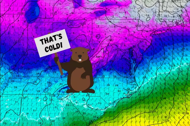
Meanwhile, your friendly neighborhood meteorologist is tracking our next arctic blast. February is notorious for cold snaps. And a cold front will send temperatures tumbling across New Jersey starting Thursday night. With a brisk wind. The biggest change in this forecast is an earlier arrival of that cold air. That means we'll probably be stuck below freezing from Thursday evening until Sunday morning — 60+ consecutive hours.
But good news: The deep freeze will not last long, as we only get clipped by this cold air mass. The long-range forecast shows a return to 40s and 50s (and maybe even 60s?) from Sunday through next week.

Thursday
A typical February day. We are starting off with temperatures in the teens in the northwest hills, with 20s throughout the rest of the state. You may consider dressing in layers, to combat the chill in the air.
High temperatures Thursday afternoon will reach about 40 degrees. Again, par for the course for this time of year.
A storm system passing south of the Garden State Thursday will lead to increased cloud cover, mixed with periods of sun. A quick shower in Cape May County is possible at some point.
By dinnertime Thursday evening, the wind will start to kick up a bit. The cold front — the leading edge of colder, drier air — is expected to cross NJ from north to south between about Midnight and daybreak Friday morning. There could be a few isolated snow showers associated with the frontal passage, but it should remain mainly dry.
Friday
The very definition of blustery, as cold air and a brisk wind take hold.
Temperatures will probably be in the mid 20s for most around sunrise. And thermometers will fall back to around 20 degrees (give or take) by late afternoon — there will be some teens out there. Skies will turn sunny, and the air and weather will be very dry. But it will be an uncomfortable and bitter day, with top wind gusts between 30 and 40 mph.
Friday night, we potentially fall in the "danger zone" as the combination of cold and wind could push the wind chill below zero. Remember, the "wind chill factor" goes way beyond just serving as the "feels like" temperature. It is the "apparent" temperature, an important factor in determining human health impacts from such freezing cold conditions.
A Wind Chill Advisory has been issued for Sussex and western Passaic counties, in effect from 5 p.m. Friday to 9 a.m. Saturday.
The wind chill may descend as low as 10 to 20 degrees below zero in that coldest sector of the state. That's the time you want to hunker down somewhere warm, hopefully with heaters and sweaters and blankets galore. (Note: If the forecast continues to trend colder overall, I would not be surprised to see this advisory expanded to other counties.)
Saturday
By early Saturday morning, low temperatures will end up between about 3 and 13 degrees. Brrr!
High temperatures on Saturday will be limited to the mid 20s. Below freezing all day. At least the wind will be less prominent, but any little breeze (10 to 15 mph) will bite. Sunshine will offer little respite from the cold.
Sunday
Just like that, the cold snap is over. Temperatures will climb into the mid 40s Sunday afternoon. So we swing from 15 degree below normal, to about five above.
Unfortunately, Sunday will turn pretty cloudy. And we may have to dodge some late-day showers. (Only the GFS model shows wet weather for now, so I would not go further than to suggest a "chance" for raindrops.)
Monday & Beyond
The first full week of February features a return to the weather pattern we saw all January — mild and relatively quiet. 50 degrees looks likely for Monday, Tuesday, and Wednesday. A storm system in the Wednesday-Thursday time frame could drive in a few showers at some point. (Those are rain showers, for the record.)
Apologies to NJ snow-lovers, but there are no real wintry weather signals through the midpoint of February.
Dan Zarrow is Chief Meteorologist for Townsquare Media New Jersey. Follow him on Facebook or Twitter for the latest forecast and realtime weather updates.
Fun Things To Do In The Atlantic City Area During The Winter Cold
Cough, cough: NJ's favorite lost voice and sore throat remedies
More From SoJO 104.9 FM
