
NJ weather: One more pleasant day before snow and rain return
The Bottom Line
Thursday will be problem-free. Thursday night will be quiet. Friday morning too.
And then our next storm system drives in. For the 7th time this season, accumulating snow is in the forecast for North Jersey. But that will not be the case everywhere Friday, as rain dominates northeastern, central, southern, and coastal New Jersey. The brunt of the storm will be Friday night.
As that weathermaker wraps up Saturday morning with one final push of widespread wintry mix, we have to keep a watchful eye on the next one early next week.

Thursday
Probably the nicest day of the week. And the warmest day of the next week, at least.
Our weather will be under the influence of high pressure Thursday, as sinking air allows for bright skies, light winds, dry air, and dry weather. We are starting the day with temperatures around 30 degrees. Highs Thursday afternoon will hover around 50. That is right around or just above normal for early March.
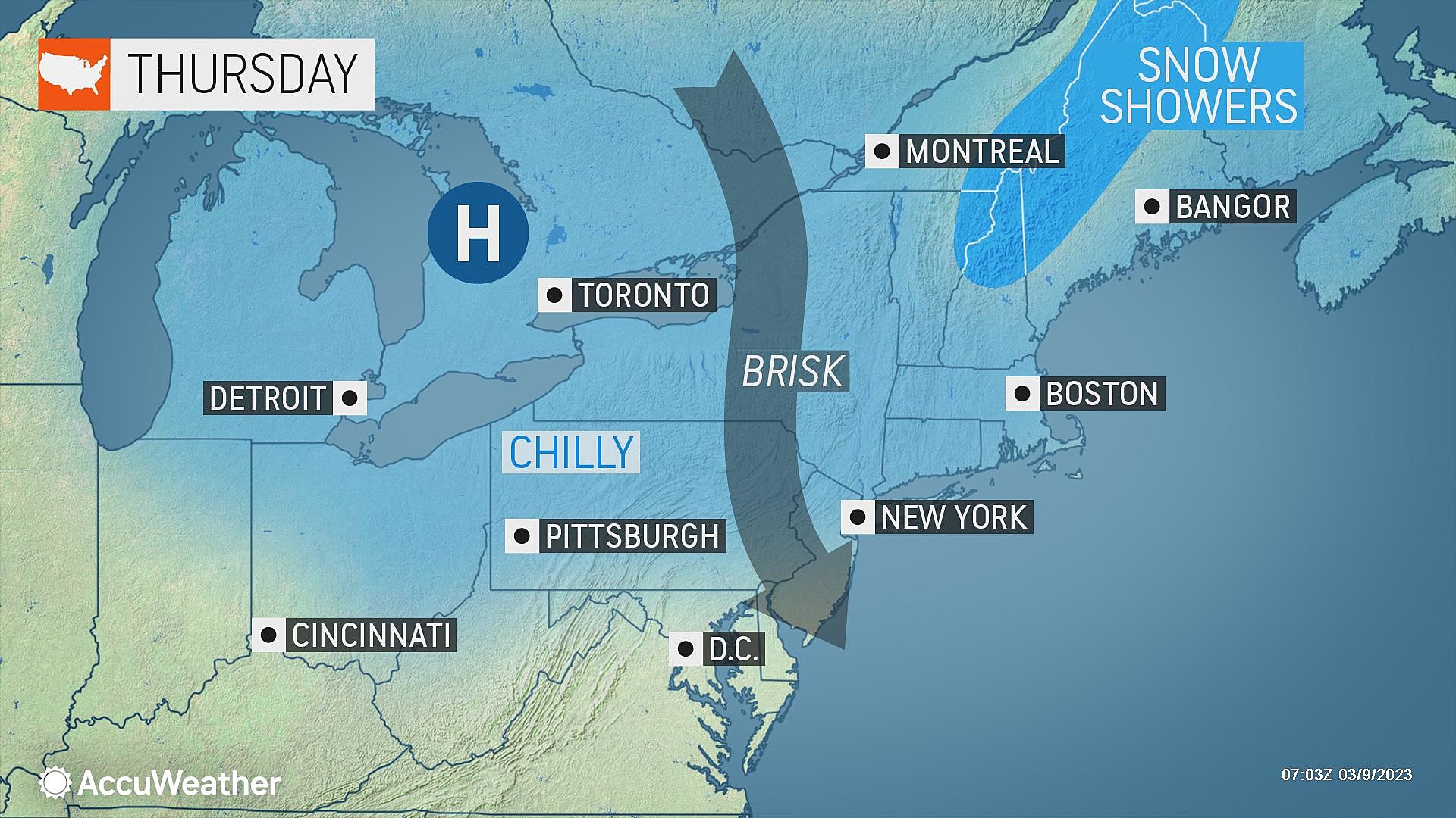
Morning sunshine will gradually hide behind fair weather clouds through the afternoon. Cloud cover will continue to increase Thursday night. Once again, overnight low temperatures will dip to around the 30-degree mark.
Friday
Our weather will go downhill eventually on Friday. But the morning looks fine. Expect mostly cloudy skies, and a midday high temperature around the mid 40s. Cooler than Thursday.
And then our next storm system pushes in from the west. Forecast models have nudged slightly earlier once again, putting first precipitation over western New Jersey around lunchtime/midday Friday.
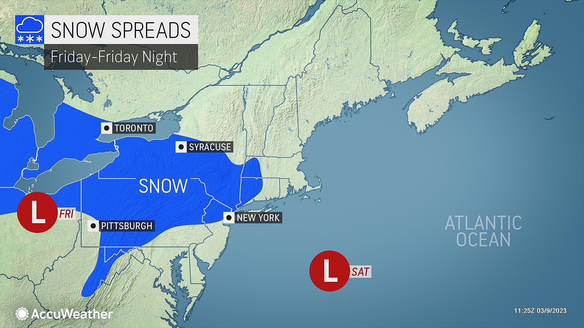
I am still confident that the initial precipitation type for most of New Jersey will be plain rain. That includes southern, coastal, central, and northeastern NJ. However, northwestern New Jersey will likely be cold enough to sustain snow (or at least a wintry mix) for the entirety of this storm system's visit. So that's where we are focusing the possibility for light to moderate accumulations.
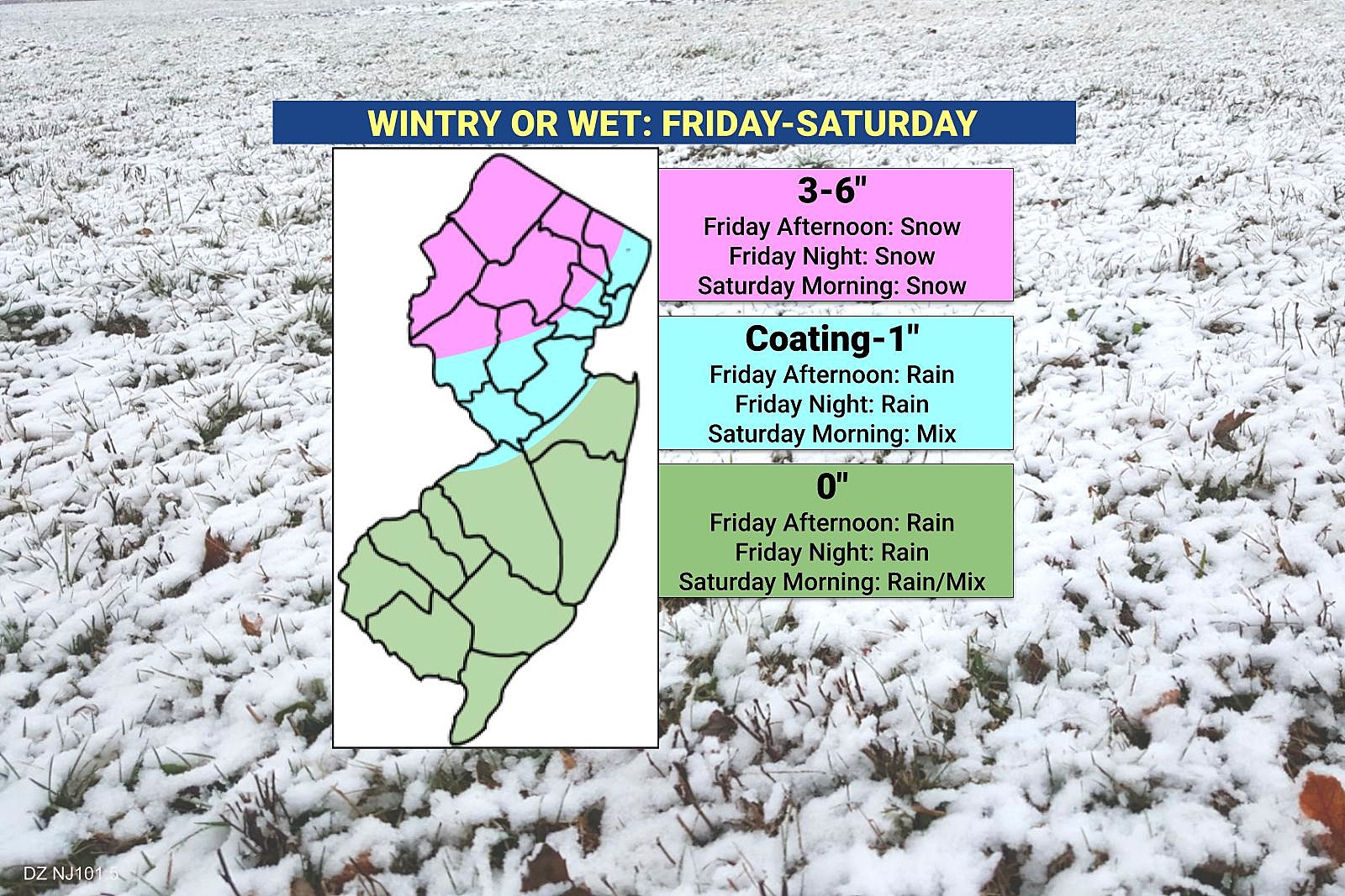
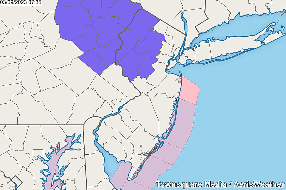
In fact, a Winter Weather Advisory has been issued for Sussex, Warren, Morris, Hunterdon, and Somerset counties from 1 p.m. Friday through 10 a.m. Saturday. The advisory pinpoints the area most likely to see 3+ inches of snow, and cautions of tricky travel conditions along the I-80, I-78, and I-287 corridors. I would not be surprised to see the advisory push farther east into Passaic and Bergen counties as the system gets closer.
The rain and snow will probably scale back and taper a bit around Midnight Friday night. But we're not out of the woods for sloppy, slippery weather just yet.
Saturday
Here's where the forecast gets especially tricky.
Forecast models have been persistent in showing one last round of precipitation between daybreak and midday Thursday. And with an influx of colder air, there is a good chance that grand finale will be widespread wintry mix — both snowflakes and raindrops possibly extending into central and even southern New Jersey.
So I think everyone needs to be aware of that possibility of slick conditions Saturday morning. But massive accumulations? Not really.

Improvements will take over Saturday afternoon, although it will be breezy to windy for a few hours as the primary area of low pressure gathers steam over the Atlantic. Skies will slowly clear, with temperatures mainly in the lower 40s. (Probably stuck in the 30s where fresh snow is on the ground, to the northwest.)
Sunday-Monday
Daytime hours on Sunday look fine. Early sunshine will give way to clouds. High temperatures will be just below seasonal normals, in the mid 40s.
Our next storm system will come into view Sunday night into Monday. And we do not have a good read on this one yet at all — especially since we have another winter storm "in the way" in the forecast right now.
There are two or three possible scenarios on the table for early next week:
1.) Periods of snow and rain, with the steadiest coming early Monday morning. Snow accumulations of 1 to 3 inches would be possible.
2.) A thorough soaking, especially during the day on Monday. The northern edge of NJ might be cold enough for a snowy or icy situation, possibly yielding significant accumulations and travel problems.
3.) While no operational forecast model currently paints such a solution, there is a colder and much snowier possibility in play here.
I do not think that third "wintry" scenario is the most likely. However, it is the reason we are going to scrutinize this system very carefully. Especially once the Friday-Saturday storm exits, and we get clearer resolution.
The Extended Forecast
Next week trends cooler-than-normal, with occasional showers. But no big storm systems.
In fact, long-range forecasts show pretty dormant weather through the start of Spring. I don't want to say we are totally out of the woods for "big snow" just yet. (And "little" snow is still possible well into April.) However, it is worth mentioning that conditions are not looking good.
Dan Zarrow is Chief Meteorologist for Townsquare Media New Jersey. Follow him on Facebook or Twitter for the latest forecast and realtime weather updates.
Let it snow: 12 things to know about winter forecasting in NJ
Gallery Credit: Dan Zarrow
BEEP BEEP BEEP: These are the 13 types of Wireless Emergency Alerts auto-pushed to your phone
Gallery Credit: Dan Zarrow
More From SoJO 104.9 FM
