NJ beach weather and waves: Jersey Shore Report for Mon 10/3
Advisories
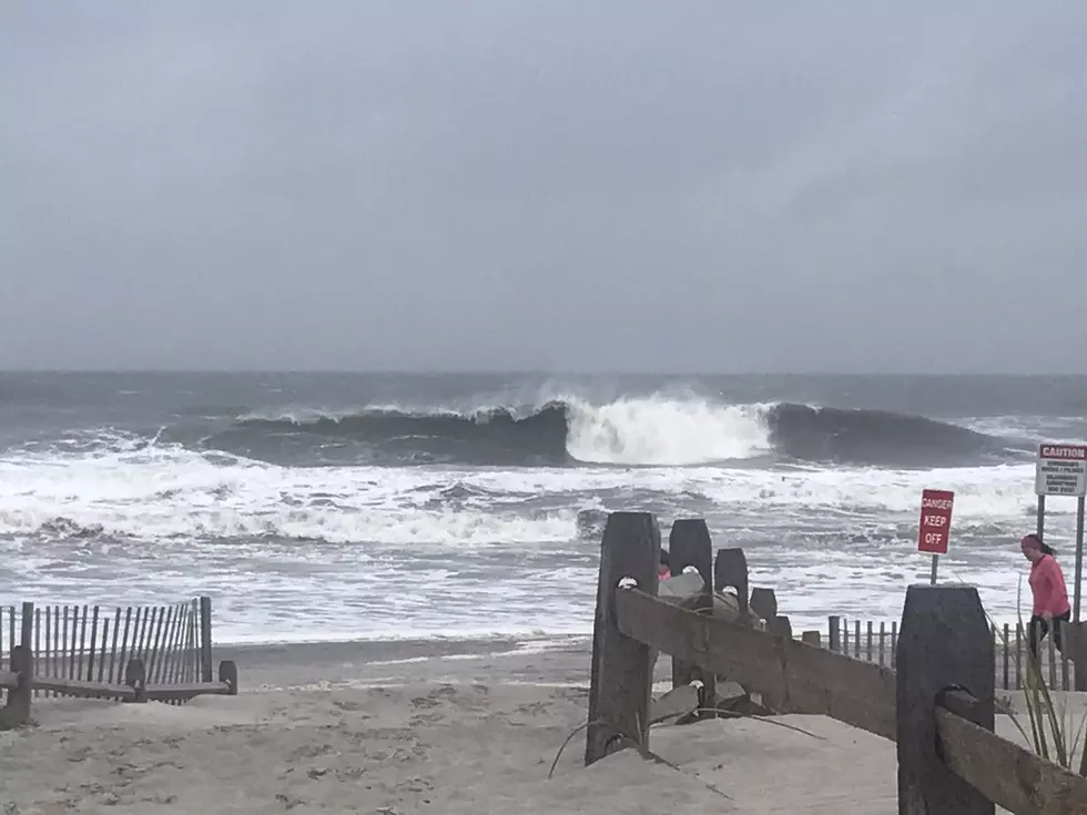
HIGH RISK OF RIP CURRENTS. Dangerous and potentially life threatening conditions exist for all people entering the surf.
GALE WARNING IN EFFECT until 6 p.m. Tuesday. Northeast winds 25 to 35 kt with gusts up to 45 kt and seas 9 to 14 ft. will cause hazardous seas which could capsize or damage vessels and reduce visibility.
At the Shore
Current conditions and forecast as of Mon morning
| Rip Current Risk | High |
|---|---|
| Waves | 6 - 12 feet |
| Winds | From the Northeast 23 - 33 mph (Gust 43 mph) 20 - 29 knots (Gust 37 knots) |
| Ocean Temperature | 63° - 70° (Normal 61° - 63°) |
| Air Temperature | 58° - 61° |
| Sunrise/Sunset | 6:54am - 6:40pm |
| UV Index | 2 (Low) |
Tide Times
| SANDY HOOK Sandy Hook Bay | Low Mon 8:18a | High Mon 2:36p | Low Mon 9:31p | High Tue 3:15a | |
| LONG BRANCH Atlantic Ocean | Low Mon 7:42a | High Mon 2:10p | Low Mon 8:55p | High Tue 2:49a | |
| MANASQUAN INLET Atlantic Ocean | Low Mon 7:54a | High Mon 2:24p | Low Mon 9:07p | High Tue 3:03a | |
| SEASIDE HEIGHTS Atlantic Ocean | Low Mon 7:46a | High Mon 2:06p | Low Mon 8:59p | High Tue 2:45a | |
| SEASIDE PARK Barnegat Bay | High Mon 5:47a | Low Mon 12:23p | High Mon 6:16p | Low Tue 1:36a | |
| BARNEGAT INLET Barnegat Bay | Low Mon 8:15a | High Mon 2:28p | Low Mon 9:29p | High Tue 3:12a | |
| MANAHAWKIN BRIDGE Manahawkin Bay | Low Mon 11:57a | High Mon 5:23p | Low Tue 1:10a | High Tue 6:02a | |
| LITTLE EGG INLET Great Bay | Low Mon 8:40a | High Mon 3:19p | Low Mon 9:55p | High Tue 3:56a | |
| ATLANTIC CITY Atlantic Ocean | Low Mon 7:41a | High Mon 2:18p | Low Mon 8:59p | High Tue 3:00a | |
| OCEAN DRIVE BRIDGE Townsends Inlet | Low Mon 8:02a | High Mon 2:55p | Low Mon 9:24p | High Tue 3:25a | |
| WILDWOOD CREST Atlantic Ocean | Low Mon 7:47a | High Mon 2:23p | Low Mon 9:06p | High Tue 3:07a | |
| CAPE MAY Delaware Bay | Low Mon 8:42a | High Mon 3:24p | Low Mon 9:49p | High Tue 4:02a |
Marine Forecast
From the National Weather Service, Mt. Holly
MON: NE winds 25 to 30 kt, diminishing to 20 to 25 kt in the afternoon. Seas 9 to 12 ft. E swell 7 to 12 ft at 9 seconds. Light swells. A chance of showers.
MON NIGHT: NE winds 20 to 25 kt, increasing to 25 to 30 kt after midnight. Seas 9 to 11 ft. E swell 6 to 11 ft at 9 seconds. Light swells. A chance of showers in the evening, then showers likely after midnight.
TUE: NE winds 25 to 30 kt. Seas 9 to 11 ft. E swell 6 to 11 ft at 9 seconds. Light swells. Showers likely.
TUE NIGHT: NE winds 20 to 25 kt with gusts up to 35 kt. Seas 7 to 10 ft. E swell 6 to 11 ft at 8 seconds. Light swells. Showers likely, mainly in the evening.
WED: NE winds 20 to 25 kt, becoming N 15 to 20 kt in the afternoon. Seas 6 to 9 ft. NE swell 5 to 9 ft at 8 seconds. Light swells. A chance of showers.
WED NIGHT: N winds 10 to 15 kt. Seas 4 to 7 ft. NE swell 3 to 7 ft at 7 seconds. Light swells. A chance of showers in the evening.
THU: N winds 5 to 10 kt, becoming SW. Seas 3 to 5 ft.
FRI: SW winds around 10 kt, becoming NW. Seas 2 to 3 ft.
Plan Your Trip
Data on this page amalgamated from several sources, including the National Weather Service (weather), National Ocean Service (tides), U.S. Naval Observatory (sun), and the U.S. Environmental Protection Agency (UV index).
Dan Zarrow is Chief Meteorologist for Townsquare Media New Jersey. The Shore Report is generated semi-automatically daily at 5 a.m. from mid-May to late September. Follow Dan's weather blog, Facebook page, and Twitter feed for your latest forecast and realtime weather updates.
Why you shouldn't visit the Jersey Shore this summer
Gallery Credit: Mike Brant - Townsquare Media
The Tastiest Jersey Shore Food Trucks You Should Try This Summer
Gallery Credit: Jimmy G
Gorgeous views: 13 NJ lake house rentals in North Jersey
Gallery Credit: Erin Vogt
More From SoJO 104.9 FM